

📌 Key Takeaways
A land survey records property information, but it cannot confirm whether your planned house will work on that land.
Boundaries Do Not Prove Fit: Your house plan also depends on terrain, access, utilities, local requirements, and how these factors affect costs.
Missing Details Leave Questions: A survey without slope or utility information leaves those conditions unknown, rather than confirming they pose no problems.
Shown Features Need Confirmation: A road or utility marking alone does not confirm usable access or available service for your planned home.
Separate Facts From Assumptions: The author recommends listing confirmed survey facts separately from questions that qualified professionals still need to answer.
Keep Early Plans Flexible: Moving the house can change driveway length, garage position, outdoor spaces, and construction costs together.
Clear boundaries still leave important building questions open.
Spicewood homeowners planning a custom home will find help separating survey facts from unanswered building questions in the guide below.
~ ~ ~ ~ ~ ~ ~ ~ ~ ~ ~ ~ ~ ~ ~ ~ ~ ~
When the Paperwork Feels Like the Answer
A land survey documents important property information, but it does not by itself establish that a specific house, access plan, utility approach or other proposed use is feasible. That gap is easy to miss, because having a survey can make a property feel settled at exactly the moment the biggest planning questions are still open.
The survey can feel like a finish line.
Picture a Saturday at 10:20 a.m. on a sloping Spicewood-area homesite (a common scenario for this terrain). Gravel crunches underfoot as a family looks from the spot where they hope the porch will catch the view down to a steep access route.
You may know that moment. The survey shows where your land begins and ends, and it feels like solid ground. We have the paperwork. The dream home should work here. Yet a quieter question is still waiting: where would the house, the driveway and the outdoor space you have been sketching actually sit?
That open question does not mean the property is unsuitable. It means the survey and your home design answer different questions. Knowing where one stops and the other begins lets you make clear decisions before committing to detailed plans.
In Spicewood, property-first custom home discovery rests on the same idea: check the ground before drawing the house on paper.
What a Survey Can Tell You
A survey is a professional measurement of a tract of land, its boundaries and its contents. Surveys are not all alike. The Texas Real Estate Research Center at Texas A&M describes several survey types, including land title, construction and topographic surveys. Each one is prepared for a different purpose.
What Should You Look for First on a Property Survey?
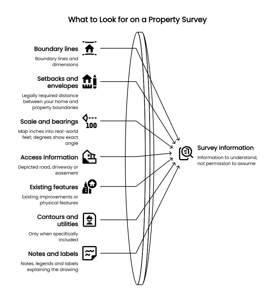
Start with what is actually drawn and labeled. Depending on the survey type, that may include:
Boundary lines and dimensions
Setbacks and building envelopes, which dictate the legally required distance between your home and the property boundaries
The scale and bearings. The scale translates map inches into real-world feet, while bearings use degrees to show the exact angle of your property lines.
Access-related information, if represented. A depicted road, driveway or easement does not on its own establish legal access or suitability for construction.
Existing improvements or physical features, if shown
Contours, utilities or other infrastructure, only when specifically included. A utility marking does not establish service availability or capacity.
Notes, legends and labels explaining the drawing
Read the legend, the notes and any stated limitations closely. A symbol that looks familiar may carry a specific meaning within that particular document.
Contour lines connect points of equal elevation. The U.S. Geological Survey’s explanation of topographic maps offers useful background on how terrain is represented. A survey without topographic information is not an elevation analysis, so its silence about slope tells you nothing about the slope.
One rule keeps this honest. If an item is shown, treat it as information to understand, not as permission to assume your preferred home will work. If the condition is not shown, do not assume either way. A blank space on paper says nothing reliable about the ground.
This is general guidance, not a reading of your particular survey. The surveyor who prepared it, or another qualified professional, should explain what its markings mean for your property.
Why a Survey Still Does Not Prove Your House Will Fit
A survey shows where your land is. It does not show whether your home fits on it. Your real question is not where the boundaries sit. It is whether the home and lifestyle you have in mind can be responsibly developed on this property.
That question reaches well beyond a boundary drawing. House fit depends on how site conditions, access, infrastructure, the rooms you want, outdoor-living goals and local requirements interact. It also depends on the budget implications those factors create together. Across the Hill Country, those conditions differ from lot to lot, and no general rule settles them for your land.
Imagine a household planning a single-story home with a large covered patio. On paper the property looks spacious. They picture the living areas turned toward the view, with the garage near the entrance. The survey can confirm the parcel’s depicted dimensions without settling whether that arrangement is practical:
A sloping approach might shape the driveway.
The chosen house spot could need further site investigation.
Utility connections may need separate confirmation.
Applicable restrictions could limit where particular improvements can go.
Those questions rarely stay separate. Moving the house changes driveway length, garage orientation, outdoor living arrangements and construction costs, all at once.
An attractive floor plan can be perfectly reasonable as a design concept and still be unverified as a plan for this particular site. So avoid irreversible design assumptions until land conditions and construction feasibility are understood.
The Risk of Treating Paper Boundaries Like a Build Plan
The greatest planning risk is not misreading a detail on the survey. It is letting an unanswered question harden into a fixed assumption.
Fast forward to a Tuesday evening at the kitchen table. Paper sketches rustle beside a budget note as two partners try to work out which design choices are driving costs. The survey boundaries look clear, yet nobody can say whether the access route suits the house or how utilities would reach the chosen spot. Their instinct is to request more detailed drawings.
That instinct is understandable, but it rarely helps. In fact, it can make things harder, because a more polished floor plan cannot establish a property fact nobody has confirmed. It simply stacks more of the plan, and more of the budget conversation, on an assumption. Window placement, garage position and patio orientation each begin to depend on a house location nobody has tested. If that location later shifts, every one of those decisions comes back up for reconsideration.
The survey is not failing when it leaves a buildability question unanswered. The mistake is asking it to answer a question outside what the document establishes.
Separate Survey Facts From Questions That Still Need Confirmation
Before designing, separate what the survey clearly shows from the property and design questions it leaves unresolved. Then identify who should confirm each one.
The worksheet below is an educational tool. It is not an official form, a survey interpretation or an established Riverbend Homes document. The last column reflects general practice; the right professional varies by property and question.
Survey Fact vs. Expert Confirmation Worksheet
| Survey item | Shown, not shown or unclear? | What still needs confirmation for our plan | Who can usually help |
|---|---|---|---|
| Boundaries and dimensions | Whether the house and related spaces fit within the property’s applicable constraints | The surveyor; your builder or designer | |
| Access-related features | Whether that access works for the home and for construction | Your builder; a title or legal professional for access rights | |
| Existing features or improvements | How each affects placement or design | Your builder or designer | |
| Topographic information | What the terrain means for foundation design and site work | Your builder; an engineer where needed | |
| Utility or infrastructure information | Whether the project can be served as intended | Utility providers; your builder | |
| Other notes or markings | How they affect your proposed use | The surveyor or a title professional |
Beside each row, add one sentence on why it matters to your plan. Suppose your survey shows an access-related feature. Record that it appears. Then note separately whether its legal status and its practical suitability for your proposed driveway have been confirmed.
A row marked “not shown” is not a “no.” It is an open question.
To confirm a surveyor’s registration, check with the Texas Board of Professional Engineers and Land Surveyors. The board licenses surveyors and publishes rosters.
What to Ask Before Design Hardens
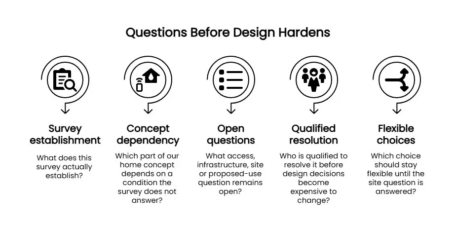
With the worksheet filled in, work through five questions as a household:
What does this survey actually establish?
Which part of our home concept depends on a condition the survey does not answer?
What access, infrastructure, site or proposed-use question remains open?
Who is qualified to resolve it before design decisions become expensive to change?
Which choice should stay flexible until the site question is answered?
A surveyor can clarify what the survey shows. Depending on the question, architects, engineers, builders, utility providers or the appropriate authorities may need to weigh in on the rest. Your job is not to solve these. Record each unknown as an open decision, not an assumption.
Where Property-First Planning Fits
Site conditions, access, infrastructure and layout affect one another. Assumptions made before those questions are checked become harder to change later.
Riverbend Homes describes holding its Discovery Meeting at the property. There, site potential, infrastructure, the homeowner’s vision and budget implications are discussed together before design is finalized. The Riverbend Homes building process also describes keeping design and budget connected as the concept develops. Permitting, financing and HOA coordination happen at later stages. Riverbend ties this approach to its Hill Country experience with site selection, landscape-sensitive design and local regulations.
Here is the honest part: a first property visit opens the conversation. It is not a technical approval, and no process can promise that a particular lot or budget will work. What it offers is timing, because questions surface while your family still has choices. If you are still weighing a parcel, these questions to raise before making an offer on Spicewood land extend the same thinking.
The Simple Takeaway
Think back to the gravel underfoot. That survey still matters, especially once you name what it does not resolve.
Use it to build two lists for your land. The first is what the document establishes. The second is what your home plan still needs someone qualified to confirm. You do not need every answer today. You only need to stop treating open questions as settled facts.
Keep that page close as the homebuilding process moves forward. The next questions will be which design choices change feasibility and cost, and how the people responsible keep the plan coordinated. This site-first guide to what your Spicewood lot can really support is a natural next read. You can also explore more Riverbend Homes guides as new questions arise.
Facts on paper. Questions on the land. Confidence in between.
Disclaimer: This content is for general educational purposes and does not replace professional land surveying, legal, engineering, architectural or property-specific feasibility advice. Site conditions, property rights, utility arrangements and applicable requirements must be evaluated by appropriately qualified professionals.
Our Editorial Process
Our expert team uses AI tools to help organize and structure our initial drafts. Every piece is then extensively rewritten, fact-checked, and enriched with first-hand insights and experiences by expert humans on our Insights Team to ensure accuracy and clarity.
About the Riverbend Homes Insights Team
The Riverbend Homes Insights Team is our dedicated engine for synthesizing complex topics into clear, helpful guides. While our content is thoroughly reviewed for clarity and accuracy, it is for informational purposes and should not replace professional advice.